Road trip Christchurch to Wanaka via the West Coast
Taking a road trip from Christchurch to Wanaka via the west coast of the South Island is a great way to discover more remote destinations. Check out this complete itinerary for details on where to stay and what to do on the west coast.
Christchurch to Wanaka itinerary
- JUCY Christchurch Airport
- Castle Hill
- Arthurs Pass
- Lake Brunner Motorcamp
- Hokitika
- Okarito Camping Ground
- Glacier Guides' Base in Franz Josef
- Franz Josef Top 10 Holiday Park
- Lake Matheson
- Fox Glacier
- Jackson Bay 'the best fish and chips in the world'
- Haast Motor camp
- Wanaka
- Glendhu Bay Motor Camp
- Treble Cone
- Cardrona pub
- Arrow River
- Arrowtown Camping Ground
- JUCY Queenstown Airport
Christchurch to Lake Brunner via Arthur's Pass
We picked up our sassy JUCY Rental from the smart new depot near Christchurch Airport and set off with no fixed itinerary, planning to meander our way over Arthurs Pass and down the West Coast to Wanaka, stopping to hike and sight see along the way,.
An hour into the trip on SH73 between Canterbury and the West Coast, we came across Castle Hill, an astonishing place with spectacular rock formations.
Wandering among the enormous limestone outcrops and columns reminded me of the fairy chimneys in Cappadocia, Turkey.
Where to stay - Lake Brunner Motor camp or Jackson's Retreat Alpine Holiday Park
Hokitika to Okarito
After a picnic lunch on the beach at Hokitika beside a silvery sea and the iconic Hokitika driftwood sign, we strolled down the beach to the river mouth past a memorial to the many ship wrecks on this rugged coast.
The next section of the drive was through a glorious native forest of tall, stately kahikatea and rimu. The views of the Kā Tiritiri-o-te-Moana/the Southern Alps from the West Coast side of the country were breath-taking.
Keen to catch a West Coast sunset, we turned off at Okarito Forks, 15km north of Franz Josef township on State Highway 6, and drove 13km to the little settlement of Okarito on a sandspit. Sitting on a driftwood log in down jackets, woollen beanies and ski gloves, we toasted a dazzling sunset.
The camping ground at Okarito was our overnight stop, a great little spot with coin-operated hot showers and an open lounge-kitchen facility. There are no cabins so you need your own camping gear.
Where to stay - Okarito Camping Ground (if you have a campervan or tent) or Franz Josef Top 10 Holiday Park.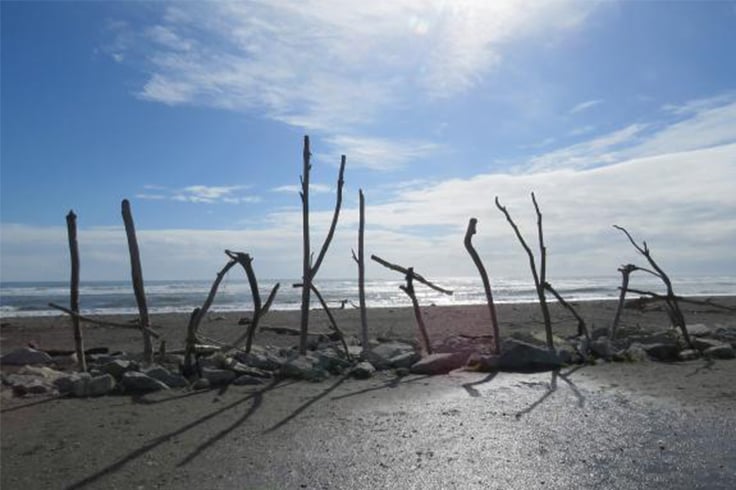
Okarito to New Zealand glacier guides' base
Next day, we explored the tiny settlement of Okarito with its quaint, rustic buildings from another era, and silvery Okarito Lagoon, the nesting ground of the rare kotuku (white heron), a bird sacred to Maori.
Thousands of native birds from more than 76 different species visit the lagoon. A small population of rowi or Okarito brown kiwi also lives nearby. There are guided tours to see the kiwi and kotuku in their natural environment. You can go kayaking on the lagoon too.
On our way down the coast, we stopped off at NZ Glacier Guides’ Base in Franz Josef and took a thrilling helicopter flight, landing high up on the glacier.
We spent an unforgettable afternoon exploring the maze of dazzling blue crevasses, ice caves and fractured chunks and pinnacles on our four-hour Ice Explorer expedition.
The 11-kilometre river of ice is one of the most accessible on the planet. The glacier descends from a height of 3000m to just 350m above sea level, terminating in a temperate rainforest 18km from the sea.
Maori call the glacier, ‘Ka Roimata o Hine Hukatere - The Frozen Tears of the Ice Maiden’ after the Ngai Tahu ancestress Hine Hukatere whose lover fell to his death and is buried under a river of frozen tears.
Where to stay - Franz Josef Top 10 Holiday Park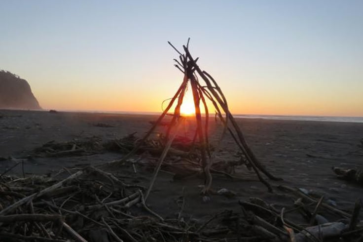
Lake Matheson to Fox Glacier
Half an hour’s drive from Franz Josef on SH6 is Lake Matheson, famous for the reflections of Aoraki/Mount Cook and Mount Tasman in the black satin water. We walked around the lake to the View of Views and Reflection Island where the panoramas of Aoraki/Mt Cook are stunning. So too are the upside-down images of the graceful rimu with its drooping tendrils and the giant kahikatea, New Zealand’s tallest tree, in the still waters of the dark lake. The colour is the result of organic matter leached from the humus of the forest floor.
The walk through the rainforest was magic. The hour and a half circuit is an easy walk but there are shorter options which are wheelchair and pushchair-friendly.
Fox Glacier, the largest and longest of the West Coast glaciers, was our next stop. We were shocked to see how far the glacier had retreated up the valley in the seven years since our last visit. At the carpark, there were many warnings of the dangers of venturing too close to the terminal face after the tragic deaths of two Australian-Indian boys who were killed when hundreds of tons of ice collapsed on them in 2009. The last part of the half-hour track to the lookout point is quite steep surrounded by sheer rock faces and towering snow-capped mountains. The viewing area, 450m from the terminal face and well above the danger zone, is definitely worth the effort.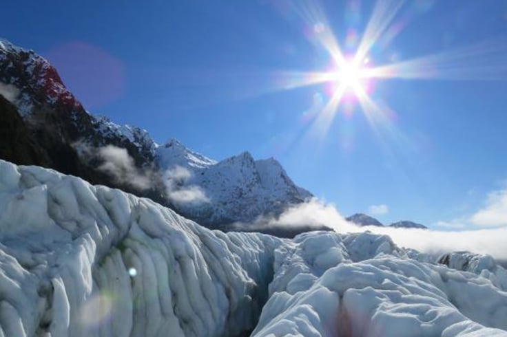
Jackson Bay at the southern-most end of the West Coast road is 51km beyond Haast and the turn-off to Wanaka. The road took us past tall, gaunt skeletons of trees with their feet in the wetlands and others permanently bent over against the wind. The Cray Pot Café at Jackson Bay reportedly has ‘the best fish and chips in the world’.
We walked along the wild, windswept, desolate beach and inspected a memorial plaque to the 400 hardy pioneers from many parts of the world who founded a settlement on this remote West Coast outpost in the 1870s. There were fishing boats bucking against their moorings at the end of a long jetty but not a soul in sight.
Retracing the road back to Haast, we crossed the swift, wide, ice-green Arawhata River and saw dozens of whitebaiters.
Where to stay - Haast Motor camp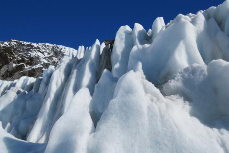
Haast to Wanaka
At Haast, we farewelled the West Coast and headed up the turquoise Haast River on SH6 surrounded by dark green bush.
As we climbed to the dramatic gates of Haast, sunshine broke through the clouds and we stopped to stretch our legs at the pretty Fantail Falls. Haast Pass, 564m, is named after Julius von Haast, a 19 century explorer who followed an old Maori route from Wanaka to the West Coast.
Ten kilometres beyond the pass on SH6 is the 60-minute (return) forest walk to the beautiful Blue Pools where the Makarora and Blue Rivers meet. The intense blue colour of the deep pools is the result of light refraction on the clear, glacier-fed, ice-cold water. It’s so clear, you can even see trout swimming about.
We emerged on the eastern more-populated side of alps and headed to Wanaka. We drove along the side of Lake Wanaka on a glorious day with snow on the mountain tops. Gorgeous Glendhu Bay Motor Camp right on the lake shore.
Where to stay - Glendhu Bay Motor Camp
We walked the stunning 15km lake-edge Millennium Track along the lake edge. The track has many ‘wow-worthy’ sights and exquisite little beaches with breath-taking views of Mt Aspiring – perfect for picnics. It also passes the absurdly-famous Wanaka tree with its adoring fan club of photographers.
Wanaka to Arrowtown
The following day, we hired Smart Motion electric bikes from Solarcycles in Wanaka and cycled along the mighty Clutha River to Luggate and back, 50km return.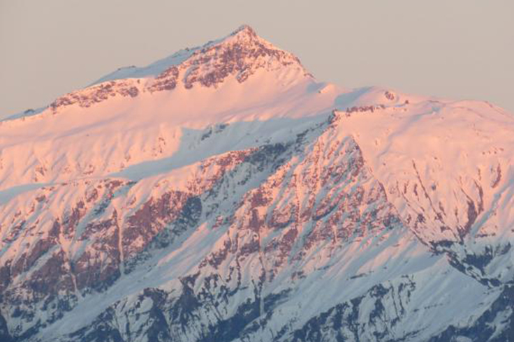
On our last day, we drove over the Crown Range road, stopping at the iconic Cardrona pub for a coffee in the sun and down the Zigzag to Arrowtown. We had famous Arrowtown pies beside the river and visited the fascinating Chinese mining village.
If you have a day to spare, walk up the Arrow River to the gold mining ghost town of Macetown settled in the early 1860s as a result of the discovery of gold in the Arrow River. At first the rush was for alluvial gold but later the miners turned their attention to the hills where several quartz mining operations were established. When the gold ran out, the town slowly died and by the 1930s, Macetown was just a ghost town.
There are two ways to get to Macetown, the track up and over Big Hill or along the scenic Arrow gorge. The latter is a 15km combination of a 4WD road and foot-track that follows the Arrow River.
Where to stay - Arrowtown camping Ground.
Want to take your own road trip around New Zealand? Book one of our awesome campervans today!